Drones for Radiation Detection in Chernobyl's Red Forest
Discover how drones are transforming radiation detection in Chernobyl’s Red Forest. Learn about cutting-edge technology, key findings, and how these innovations enhance safety, improve accuracy, and support environmental monitoring in one of the world’s most hazardous zones.

The Chernobyl disaster of 1986 released massive amounts of radioactive material into the environment, contaminating extensive areas, including the Red Forest situated near the Chernobyl Nuclear Power Plant. Traditional methods of radiation mapping using unmanned aircraft often suffer from low resolution and pose a risk of radiation exposure to crew 1. Due to the high radiation levels, the Red Forest remains one of the most dangerous areas on Earth. Accessing this area for comprehensive radiation surveys using conventional methods presents significant risks to human operators. However, recent advancements in drone technology have provided a safer and more efficient approach to studying and managing these contaminated areas. This article explores drones equipped with radiation detectors in the Red Forest, examining the technology employed and the significant findings of these missions.
Use of Drones with Radiation Detectors in the Red Forest
Following the Chornobyl disaster, the Red Forest, a 4-6 km2 area of pine forest, was heavily contaminated with radioactive material. This contamination caused the trees to die and take on a reddish-brown color, giving the area its name 2. Due to the persisting high radiation levels, access to the Red Forest is restricted, making it challenging to conduct comprehensive radiation surveys using traditional methods. To overcome these challenges, scientists have begun using drones equipped with radiation detectors.
In 2019, a team of scientists from the UK's National Centre for Nuclear Robotics (NCNR) conducted a pioneering study using drones to map radiation levels in the Red Forest 3. This marked a significant step in utilizing uncrewed aerial vehicles (UAVs) for radiation detection in hazardous environments. The drones allowed researchers to safely access and survey the contaminated area without risking human exposure to harmful radiation levels. This research was conducted to ensure the safety of the increasing number of tourists who visit the Chornobyl Exclusion Zone each year and to inform decisions about the construction of solar farms in areas with lower contamination 3.
Technology Used in Radiation Detection Drones
The drones used in the Red Forest were equipped with advanced technology to measure and map radiation levels accurately. Key components included:
- Kromek Sigma 50 Radiation Detectors: These detectors utilize CsI(Tl) scintillation technology, known for its high light output and robustness 5. The Sigma 50 is particularly well-suited for field applications due to its ability to withstand harsh conditions and its lack of cooling requirements 6.
- Gamma Spectrometers: These instruments identify and measure the energy of gamma rays emitted by radioactive materials, enabling the identification of specific radioisotopes present in the environment 7.
- LiDAR (Light Detection and Ranging): This remote sensing method uses laser pulses to create detailed 3D terrain maps 7. This technology is crucial for accurately mapping radiation levels, as it allows for precise measurements of the distance between the drone and the ground. This distance information is then used to correct the radiation data to ground level automatically, ensuring accurate measurements regardless of the drone's altitude 9.
Two main types of drones were employed in the Red Forest: fixed-wing and rotary. Fixed-wing UAVs were chosen for their efficiency and ability to cover large areas quickly 7. These drones were launched by hand and recovered using a parachute system 1. On the other hand, rotary drones were used for more detailed investigations of specific areas of interest due to their ability to hover and maneuver in confined spaces 7.
The gamma-ray spectrometry technology developed by the University of Bristol for these drone missions has been previously used in the first-ever UAV mapping of the Sellafield site in the UK. It has also been deployed numerous times in the Fukushima Prefecture in Japan 11. This demonstrates this technology’s broader applications and experience in various nuclear environments.
To better illustrate the differences between the two types of drones, the following table provides a summary of their characteristics, advantages, and disadvantages:
Results of Drone Missions in the Red Forest
The drone missions in the Red Forest yielded significant results, providing valuable insights into the area’s distribution and intensity of radiation. Key findings include:
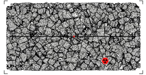
- Identification of Radiation Hotspots: The drones revealed previously unknown radiation hotspots, including one in the ruins of a soil separation facility used during post-disaster cleanup efforts 4. This hotspot emitted significant radiation levels, highlighting the importance of detailed mapping for identifying potential hazards. Another previously unreported hotspot was found near an old agricultural metal structure, further demonstrating the effectiveness of aerial mapping with drones 12.
- Detailed Radiation Mapping: The drones enabled the creation of the most comprehensive radiation map of the Red Forest to date 3. This map provides valuable information for ongoing monitoring and management efforts, helping to ensure the safety of personnel and visitors to the Chernobyl Exclusion Zone. The survey also revealed variations in radiation dose rates, providing a more detailed understanding of the risks associated with different areas within the Red Forest 12.
- Detection of Long-Lived Radioisotopes: The drones identified radioisotopes with long half-lives, indicating that radiation will persist in the Red Forest for a considerable time 4. This information is crucial for understanding the Chernobyl disaster’s long-term environmental impact and developing effective management strategies.
Impact of Radiation on the Red Forest
The Chernobyl disaster had a devastating impact on the Red Forest. High radiation levels caused widespread tree mortality, leading to the forest's distinctive reddish-brown color 2. The explosion and fire at the Chernobyl No. 4 reactor contaminated the soil, water, and atmosphere with radioactive material equivalent to that of 20 times the atomic bombings of Hiroshima and Nagasaki 13. This contamination created a mosaic of radioactive habitats, with varying contamination levels across the landscape 14. Distinct "excursions," known as the northern and western traces, carried radioactive plumes across the countryside, creating areas with significantly higher radiation levels 14.
In the immediate aftermath of the disaster, the Red Forest was largely devoid of life. However, in the years that followed, the area has seen a resurgence of wildlife. The evacuation of the area surrounding the nuclear reactor has created a lush and unique wildlife refuge 13. While biodiversity has increased, the long-term effects of radiation on the flora and fauna are still being studied. There are reports of stunted plants and abnormalities in some animal species 13. Research on Scots pine trees growing in the Red Forest has revealed elevated levels of DNA damage and subcellular abnormalities, even decades after the accident 15. Despite the significant impact of radiation, wildlife is now thriving in the Chernobyl Exclusion Zone, highlighting the resilience of nature 14.
Ongoing Monitoring and Management Efforts
Despite the challenges posed by radiation, the Red Forest has become an accidental wildlife sanctuary, with various animal species thriving without human activity 13. Ongoing efforts to monitor and manage the Red Forest include:
- Radiation Monitoring: Continuous monitoring of radiation levels is crucial to ensure the safety of personnel and visitors to the Chernobyl Exclusion Zone. Automated radiation monitoring systems and drone surveys provide valuable data for assessing radiation levels and identifying potential hazards 16.
- Fire Prevention and Management: Forest fires pose a significant risk in the Red Forest, as they can release radioactive material into the atmosphere 13. In July 2016, a severe fire burned approximately 80% of the Red Forest, highlighting the need for adequate fire management strategies 17. Efforts to prevent and manage fires include wildfire prevention measures, training for firefighters, and deploying bomb disposal teams to clear explosive devices in the area 16.
- Soil Contamination Management: There are concerns about soil contamination with long-lived radioisotopes such as strontium-90 and cesium-137 13. These contaminants can be absorbed by plants and insects, potentially entering the food chain. Ongoing research and monitoring are essential to assess the long-term risks associated with soil contamination.
Potential Benefits and Limitations of Using Drones for Radiation Detection
The use of drones for radiation detection in disaster zones offers several potential benefits:
- Enhanced Safety: Drones eliminate the need for human operators to enter hazardous areas, reducing the risk of radiation exposure 18.
- Increased Efficiency: Drones can cover large areas quickly and efficiently, enabling rapid data collection and assessment 18.
- Improved Accuracy: Drones with LiDAR and advanced sensors can provide high-resolution data and accurate measurements, leading to more detailed radiation maps 18.
- Access to Inaccessible Areas: Drones can access areas that are difficult or impossible to reach with traditional methods, such as dense forests or areas with unstable terrain 19.
- Versatility: In addition to radiation detection, drones can be used for various applications in nuclear facilities, such as detecting vibration in pumps, valves, motors, and piping systems 21. This information can help identify potential equipment failures and prevent accidents.
- Rapid Response: Drones can be deployed quickly to disaster zones, allowing for faster assessment of the situation and potentially saving lives. Studies have shown that drones can significantly reduce the time required to locate victims in disaster zones 22.
However, there are also limitations to consider:
- Payload Capacity: Drones have limited payload capacity, which can restrict the types and sizes of sensors they can carry 22.
- Weather Dependence: Drone operations can be affected by adverse weather conditions, such as strong winds or rain 1.
- Regulatory Restrictions: Drones are subject to regulatory restrictions, which can vary depending on the location and airspace 18.
Ethical Considerations
While drones offer significant advantages for radiation detection and disaster response, the ethical implications of their use must be considered. In disaster zones, where privacy and data security may be compromised, the deployment of drones raises concerns about the potential misuse of data and the violation of individual rights 23. It is crucial to establish clear guidelines and regulations for drone use in these sensitive situations to ensure responsible and ethical practices.
Conclusion
The use of drones with radiation detectors has transformed the way scientists study and manage contaminated areas like the Red Forest in Chernobyl. These uncrewed aerial vehicles provide a safer and more efficient approach to radiation monitoring, enabling the creation of detailed maps, the identification of hotspots, and the assessment of long-term environmental impacts. The research conducted in the Red Forest has demonstrated the effectiveness of drones in identifying previously unknown radiation hotspots and providing valuable data for ongoing monitoring and management efforts.
While there are limitations to consider, the potential benefits of drone technology for radiation detection are significant, particularly in disaster zones where human safety is paramount. Drones can enhance safety, increase efficiency, improve accuracy, and provide access to inaccessible areas. Moreover, their versatility extends beyond radiation detection, with applications in various aspects of nuclear facility management.
As drone technology continues to advance, it is likely to play an even more significant role in managing nuclear disasters and other hazardous situations. However, to ensure the responsible and ethical use of this technology, it is crucial to address the ethical considerations associated with drone deployment, particularly in disaster zones. The development of clear guidelines and regulations will be essential to maximize drones’ benefits while minimizing potential risks.
Works Cited
1. Harnessing drone technology to map radiation around Chornobyl - Research Features, accessed February 18, 2025, https://researchfeatures.com/wp-content/uploads/2021/02/Dean-Connor.pdf
2. www.ceh.ac.uk, accessed February 18, 2025, https://www.ceh.ac.uk/our-science/projects/tree-red-fire-radioactive-environment-damaged-fire#:~:text=The%20Red%20Forest,1986%20prior%20to%20their%20death.
3. Chernobyl nuclear fallout zone mapped by drones | UK News, accessed February 18, 2025, https://news.sky.com/story/chernobyl-nuclear-fallout-zone-mapped-by-drones-11714118
4. Drones Find Unexpected Radiation 'Hotspots' in Forest Near ..., accessed February 18, 2025, https://www.livescience.com/65435-chernobyl-forest-drone-survey.html
5. Uncovering Chernobyl hidden radioactive hotspots - Kromek, accessed February 18, 2025, https://www.kromek.com/blog/uncovering-chernobyl-hidden-radioactive-hotspots/
6. Sigma 25/50 | Caesium iodide scintillator radiation detector - Kromek, accessed February 18, 2025, https://www.kromek.com/product/sigma25-50/
7. Radiation Mapping Surveys Using UAVs in the Chernobyl Exclusion Zone, accessed February 18, 2025, https://southwestnuclearhub.ac.uk/radiation-mapping-chernobyl/
8. LiDAR Technology Helps Reveal Radiation Hotspots at Chernobyl - LIDAR Magazine, accessed February 18, 2025, https://lidarmag.com/2020/02/11/lidar-technology-helps-reveal-radiation-hotspots-at-chernobyl/
9. UAV radiation mapping drone - Kromek, accessed February 18, 2025, https://www.kromek.com/product/autonomous-airborne-radiation-monitoring-system/
10. Radiation Hotspots Revealed in Chernobyl's Red Forest—One of the Most Radioactive Sites on Earth - Newsweek, accessed February 18, 2025, https://www.newsweek.com/radiation-hotspots-revealed-chernobyls-red-forest-one-most-radioactive-sites-1417703
11. April: Chernobyl drones | News and features | University of Bristol, accessed February 18, 2025, https://www.bristol.ac.uk/news/2019/april/chernobyl-drones-.html
12. Harnessing drone technology to map radiation around Chornobyl, accessed February 18, 2025, https://researchfeatures.com/harnessing-drone-technology-map-radiation-around-chornobyl/
13. Red Forest - Wikipedia, accessed February 18, 2025, https://en.wikipedia.org/wiki/Red_Forest
14. Growing Up with Chernobyl | American Scientist, accessed February 18, 2025, https://www.americanscientist.org/article/growing-up-with-chernobyl
15. Long-term effects of ionizing radiation in the Chernobyl Exclusion zone on DNA integrity and chemical defense systems of Scots pine (Pinus sylvestris) - PubMed, accessed February 18, 2025, https://pubmed.ncbi.nlm.nih.gov/37689207/
16. Fires sweep through Chornobyl forests, containment efforts ongoing - The Kyiv Independent, accessed February 18, 2025, https://kyivindependent.com/fires-sweep-through-chornobyl-forests-containment-efforts-ongoing/
17. TREE Red Fire: Radioactive environment damaged by fire | UK Centre for Ecology & Hydrology, accessed February 18, 2025, https://www.ceh.ac.uk/our-science/projects/tree-red-fire-radioactive-environment-damaged-fire
18. Benefits of using drones in disasters - through all 4 stages - Nextech, accessed February 18, 2025, https://nextech.online/airborne-drones-reports-on-in-depth-study-reveals-how-drones-can-help-in-all-phases-of-a-disaster/
19. The Role of Emergency Drones in Disaster Management | Verizon Business, accessed February 18, 2025, https://www.verizon.com/business/resources/articles/s/the-role-of-emergency-drones-in-disaster-management/
20. Radiation-detecting Drone - Fly4Future, accessed February 18, 2025, https://fly4future.com/development-and-prototyping/radiation-detecting-drone/
21. Drones Detect Radiation - Inside Unmanned Systems, accessed February 18, 2025, https://insideunmannedsystems.com/drones-detect-radiation/
22. Drone Applications for Emergency and Urgent Care: A Systematic Review - PMC, accessed February 18, 2025, https://pmc.ncbi.nlm.nih.gov/articles/PMC9280065/
23. Application of Drones in Nuclear Contaminated Sites - E3S Web of Conferences, accessed February 18, 2025, https://www.e3s-conferences.org/articles/e3sconf/pdf/2023/61/e3sconf_icree2023_03004.pdf